Nanyuki Travel Guide: Mount Kenya, the Equator, Ol Pejeta, Where to Stay and Day Trips
Nanyuki is the market town at the foot of Mount Kenya, about 200 km north of Nairobi and almost on the equator, and it is the main gateway to Laikipia’s wildlife conservancies, the Sirimon route up Mount Kenya and the forests and farms of the northern slopes. It is a practical base with supermarkets, banks, fuel, hotels and restaurants, a cool highland climate and some of the best day trips in central Kenya. Plan a long weekend, or three to five days if you want to combine Ol Pejeta Conservancy, Ngare Ndare Forest, a Mount Kenya hike, and a Samburu extension. Confirm opening hours, fees, and road conditions before you go.
Nanyuki is a highland town in Laikipia County, in central Kenya, at the foot of Mount Kenya and right on the Equator. It is roughly a three-and-a-half- to four-and-a-half-hour drive from Nairobi and is the gateway to Mount Kenya, Ol Pejeta Conservancy, the Laikipia conservancies, and, further north, Samburu. Most visitors spend two to four days here, combining wildlife, mountain scenery, and cooler highland air.
Nanyuki feels like a different Kenya from the savanna of the south. The air is thinner and cooler, the horizon is dominated by the jagged peaks of Mount Kenya, and the landscape rolls away into wide ranchlands and conservancies where rhinos, elephants, and giraffes share the grass with cattle. It is a town of farms, army families, safari operators, and mountain guides, and the Equator runs a few kilometers away, a fact the town does not let you forget.
This guide covers what Nanyuki offers, how the town and its surroundings are laid out, what to do, where to stay, how to get around, and which day trips to add. It is written for first-time visitors, self-drivers heading to the conservancies, hikers preparing for Mount Kenya, and anyone looking for a comfortable base in the highlands. For the wider wildlife region, read our Laikipia travel guide, and if you are starting in the capital, our Nairobi travel guide covers the city before you head north.
Nanyuki at a Glance
Quick fact | What to know |
Location | Laikipia County, central Kenya, on the north-western slopes of Mount Kenya, about 200 km north of Nairobi |
What it is | The largest town in Laikipia, a market, farming, and tourism center with a military presence and a small airport |
Famous for | The equator crossing, views of Mount Kenya, Ol Pejeta Conservancy, the Sirimon climbing route, trout fishing, golf, and a historic safari-club tradition |
Languages | English and Swahili, along with Kikuyu, Meru, Maasai, and Samburu communities |
Climate | Cool and bright, usually about 8 to 25°C, with cold nights and mornings and two rainy seasons |
Altitude | About 1,950 m above sea level, so mild days, strong sun, and chilly evenings |
Currency | Kenyan shilling (KES). You can use cards in hotels and larger shops, and M-Pesa and cash are accepted everywhere. |
Time needed | A long weekend for the town and Ol Pejeta, and three to five days with Mount Kenya, Ngare Ndare, and a conservancy stay |
Main areas | Town center and market, the Equator Road, Timau, Naro Moru, Sweetwaters, and the Mount Kenya foothills |
Best for | A safari base, hikers, self-drivers, short breaks from Nairobi, families, and golf and fishing fans |
Is Nanyuki Worth Visiting?
For many travelers, yes, particularly if you want a safari that is quieter, cooler, and more varied than the classic Southern circuit. Nanyuki offers a rare combination: a high mountain, working conservancies with strong rhino conservation programs, and landscapes that range from forest to open plains, all within an hour or two of the town.
It also suits travelers who like a change of pace. Walking, horse riding, cycling, and night drives are available at some conservancies, depending on the property and its rules, and the highland climate makes outdoor activities comfortable. If you are building a longer Kenya route, Nanyuki is a natural stage between Nairobi and Samburu.
Who it suits best
- Self-drivers who want a short, scenic trip from Nairobi.
- Wildlife lovers visiting Ol Pejeta, Lewa, Borana, and other conservancies.
- Hikers and climbers heading for Point Lenana and the Sirimon route.
- Families, thanks to short drives, animals, and accessible facilities.
- Budget travelers who prefer town hotels to luxury camps.
- Golfers, riders, and anglers who enjoy the highland clubs and streams.
Top Things to Do in and around Nanyuki
Nanyuki town and the equator
Attraction | What you get | Tips |
The equator crossing | Signposts and curio stalls on the road just outside town, where guides demonstrate water swirling in opposite directions | A quick photo stop. Agree on any demonstration fee first. |
Nanyuki market and town center | Fresh produce, flowers, fabrics, hardware, and everyday local life | Go in the morning, keep valuables out of sight, and bargain politely. |
Craft cooperatives | Rugs, weaving, and handicrafts made by local groups | Good for authentic gifts. Check opening hours. |
Sportsman’s Arms and historic stays | A long-standing colonial-era hotel and other landmarks of the town’s safari history | Visit for lunch or a drink. |
Cafes and bakeries | Coffee, pastries, and light meals are popular with locals and visitors. | Handy for a breakfast stop before a game drive |
Wildlife and nature
Attraction | What you get | Tips |
Ol Pejeta Conservancy | Rhinos, the last northern white rhinos under guard, the Big Five wildlife, cheetahs, and the Sweetwaters Chimpanzee Sanctuary | It is located about 20 to 30 km from town. Day visits are possible, so book rhino and night-drive experiences ahead. |
Ngare Ndare Forest | A canopy walk, waterfalls, natural pools, and an elephant corridor | About 30 km away. Go in the morning and wear walking shoes. |
Solio and other nearby reserves | Private rhino areas and conservancies on the slopes | Usually need advance booking. Check access rules. |
Mount Kenya Wildlife Conservancy and Naro Moru area | Animal rescue, birds, forests, and trout streams | This can be combined with a drive south along the mountain. |
Lewa, Borana, and Loisaba conservancies | Rhinos, wild dogs, walking, and horse safaris | Mostly for lodge guests. See our Laikipia travel guide. |
Mount Kenya and the Sirimon route
Mount Kenya is a UNESCO World Heritage site and Kenya’s highest peak. The Sirimon route starts about 30 km from Nanyuki and climbs gently through forest, moorland, and alpine scenery towards Point Lenana, a non-technical summit at roughly 4,985 m. The higher peaks, Batian and Nelion, need technical mountaineering skills. Most trekkers take three to five days and need a licensed guide and porters. Altitude sickness is a real risk, so acclimatize, drink water, and descend if symptoms worsen. Day walks into the lower moorland are also possible with a guide, and they give wonderful views without the full climb. Park fees, permits, and route rules change, so confirm with the Kenya Wildlife Service and your operator.
Active and outdoor
- Hiking and day walks on the lower slopes of Mount Kenya.
- Trout fishing in streams and lodges around Nanyuki and Naro Moru.
- Golf at the Nanyuki Sports Club and the course at the Mount Kenya Safari Club.
- Horse riding at clubs and conservancies, usually by booking.
- Cycling and mountain biking on quiet roads and guided routes.
- Bird watching in the forest, farmland, and conservancies.
- Farm and flower visits around Timau, where greenhouses and vegetable farms supply markets and exporters.
Food and drink
- Local grills and nyama choma: goat and beef with ugali and kachumbari.
- Trout: fresh trout from highland streams is a regional specialty, often grilled or pan-fried.
- Dairy and farm produce: milk, cheese, honey, and vegetables from nearby farms.
- Bakeries and cafes: coffee, mandazi, cakes, and sandwiches.
- International choices: pizza, curries, and burgers in town, plus lodge dining and bush meals in the conservancies.
- Fresh fruit and street snacks: roasted maize, mandazi, and fruit from market stalls.
Day Trips and Wildlife Near Nanyuki
Nanyuki is an excellent base because so much lies within easy reach. Distances below are approximate by road, so allow extra time for traffic, rain, and rough tracks.
Place | Approx. distance | Famous for | Tips |
The equator signpost | About 5 to 8 km | A photo stop on the road north | Combine with a town visit. |
20 to 30 km | Rhinos, chimpanzees, and the Big Five | Easy day trip or overnight | |
Ngare Ndare Forest | About 30 km | Canopy walk and waterfalls | Go in the morning. |
Mount Kenya, Sirimon Gate | About 30 km | Hiking and alpine scenery | Book climbs with a licensed operator. |
Naro Moru | About 30 to 40 km | Trout streams and the Naro Moru route | Pair with a mountain walk. |
Lewa Wildlife Conservancy | About 60 km, 1 to 1.5 hours | Rhinos, Grevy’s zebra, and birdlife | Mostly for lodge guests |
Isiolo | About 60 km | Gateway to the north and a lively market town | Fuel and supplies before Samburu |
Samburu, Buffalo Springs, and Shaba reserves | About 100 to 130 km, 2.5 to 3 hours | Northern species and the Ewaso Nyiro River | A good add-on for two nights |
Nyeri and the Aberdare area | About 55 to 90 km, 1 to 2 hours | Forest, waterfalls, and treetop lodges | Often paired with Laikipia |
Nyahururu and Thomson’s Falls | About 100 km, around 2 hours | A highland waterfall and cooler air | A scenic drive with a lunch stop |
Meru National Park | 3 to 4 hours | Quiet savannah and rivers | A good extension for a longer trip |
Tip: Kenya Wildlife Service (KWS) manages national parks and reserves, while Laikipia’s conservancies set their own fees and rules. Fees, permits, and payment systems vary and change, so confirm directly before you go
Best Time to Visit Nanyuki
Nanyuki has a cool, bright highland climate. The sun is strong during the day, evenings are cold, and rain can arrive quickly, especially in the rainy seasons.
- For the driest weather and the clearest views of Mount Kenya: January to March and July to September.
- For the best wildlife viewing and dry roads: June to October and December to March.
- For the long rains: about April to May, with muddy tracks, lower rates, and fewer visitors.
- For the short rains: November, usually lighter, with green landscapes.
- For the coldest nights and mornings: July and August, when a warm jacket is essential.
- For holiday crowds: late December to early January and school holidays, when hotels fill and advance booking is wise.
Mount Kenya’s weather changes fast. The drier months suit climbing, but conditions can still turn cold, wet, and windy.
How to Get to Nanyuki
- By road: the drive from Nairobi is about 200 km through Thika, Sagana, Karatina, and Naro Moru and usually takes 3.5 to 4.5 hours, depending on traffic. Start early to avoid heavy traffic out of Nairobi.
- By air: flights from Wilson Airport in Nairobi to Nanyuki take about 45 minutes, and small airstrips at Ol Pejeta, Lewa, and other conservancies serve lodge guests. Baggage limits are strict on small planes.
- By bus and matatu: regular services link Nairobi and Nanyuki, but they do not reach the conservancies, so plan onward transport.
- From Nyeri and the Aberdares: a short drive of about an hour across the highlands.
- From Naivasha and Nyahururu: a scenic route through the Laikipia plateau.
- From Isiolo and Meru: roads connect the north and east with Nanyuki, and Meru routes may be slower.
- Cross-border: road links from Uganda and Tanzania need a long drive, and cross-border car hire requires special permission. See our guide to cross-border car rental from Kenya.
Getting Around Nanyuki
- Car hire: the best way to explore if you plan to visit Ol Pejeta, Ngare Ndare, and the mountain. See the vehicle guidance below.
- Driver-guide: helpful for rough roads, wildlife spotting, and long days.
- Taxis and tuk-tuks: available in town for short trips and evenings.
- Boda-bodas (motorbike taxis): common and cheap but riskier, so check your insurance.
- Matatus: inexpensive for local hops, best for experienced travelers.
- Lodge transfers: most lodges and conservancies arrange pick-ups from town or the airstrip.
- Walking: easy in the town center in daylight, but avoid isolated areas after dark.
- Fuel and services: Refuel in Nanyuki before heading into conservancies, where fuel may be limited.
Where to Stay in Nanyuki
Choose your base according to what you want from the trip. Town hotels are best for budget and flexible plans, Ol Pejeta is ideal for wildlife-focused stays, the mountain foothills are particularly well-suited for hikers and anglers, and private conservancies are perfect for luxury.
| Area | Best for | What to expect |
| Nanyuki town | Budget, supplies, and flexible stays | Hotels, guesthouses, supermarkets, banks, and restaurants |
| Equator Road and outskirts | Quiet stays close to town. | Lodges, cottages, and small hotels with garden settings |
| Ol Pejeta Conservancy | Rhinos, chimps, and first-time visitors | Tented camps, cottages, and lodges, including family options |
| Mount Kenya foothills and Naro Moru | Hikers, anglers, and mountain views | Lodges, cottages, and campsites near the trails and streams |
| Timau and Ngare Ndare | Forest and mountain scenery | Small lodges and campsites near the canopy walk |
| Private conservancies | Luxury, conservation, and active safaris | Intimate camps with walking, horse riding, and night drives |
Well-known stays reported by published guides include Fairmont Mount Kenya Safari Club and Sportsman’s Arms Hotel near Nanyuki, Sweetwaters Serena Camp and Ol Pejeta Bush Camp at Ol Pejeta, and a range of mid-range hotels and self-catering cottages around town and the Naro Moru road. Many conservancy lodges are expensive and need early booking, especially in high season, so compare current rates and confirm what is included. Check that each property is still operating before you book. If you plan to camp on a longer trip, you can arrange equipment through camping gear and rooftop tent rental.
Budget tips: stay in Nanyuki and visit Ol Pejeta by day, travel in the April to May rains, and choose self-catering cottages or campsites.
Self-Drive, Driver-Guided, or Flying: Choosing Your Transport
Self-drive is permitted in Kenya, and the road to Nanyuki is paved and busy. Traffic through towns, trucks, and matatus are the main challenges. Inside conservancies and on mountain tracks, roads can be rough, steep, and slippery after rain, and some conservancies require guests to use lodge vehicles for certain activities.
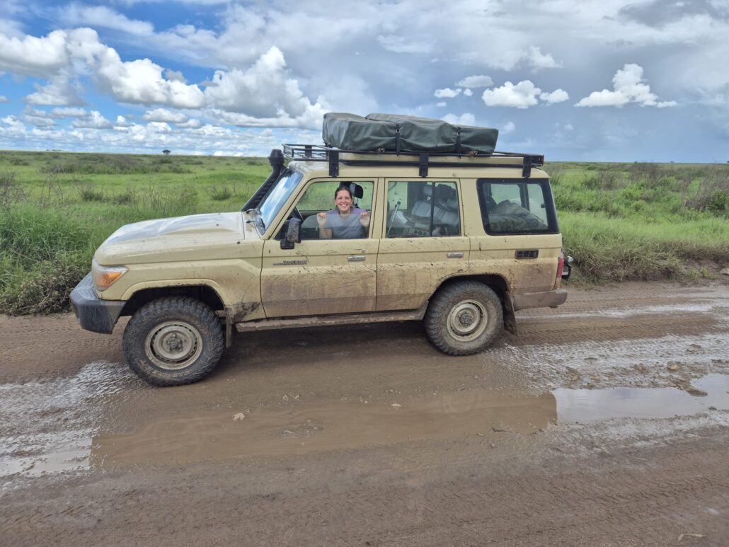
If you want to compare vehicles, see car rental Nanyuki, and for the drive from the capital, read about Nairobi to Nanyuki self-drive.
If you want… | Choose | Why |
To reach Nanyuki and Ol Pejeta | A compact SUV or 4×4 | Paved road to town, with good tracks into Ol Pejeta |
Conservancies, Sirimon Gate, or rough tracks | A high-clearance 4×4 | Better on stones, mud, and steep sections |
Stress-free wildlife viewing | A driver-guide | Local knowledge, spotting and navigation |
Group or family wildlife trips | A safari vehicle with a pop-up roof | Standing views and photographs for everyone |
A one-way trip to Samburu or the Mara | One-way car rental | Collect in one place and drop in another. |
Camping on a longer route | Camping gear and rooftop tent rental | Useful for Mount Kenya, Ngare Ndare, and Samburu |
Short on time | Scheduled or charter flights | Fast, but costly and with baggage limits |
Road rules and safety, whichever vehicle you choose
- Drive on the left, keep to the speed limit, and expect police checkpoints.
- Avoid night driving on public roads, where trucks, livestock, and wildlife are common.
- Keep to marked tracks inside conservancies, and follow ranger and lodge instructions.
- Never approach wildlife on foot or leave the vehicle except in designated areas.
- Carry water, a spare tire, a charged phone, and offline maps, since signal can be patchy.
- Allow extra time through Karatina, Naro Moru, and Nanyuki, where traffic and roadworks can slow you down.
Local notes from our team Timing: leave Nairobi early to reach Nanyuki by lunchtime and enter conservancies in daylight. Roads: allow extra time after heavy rain, especially on black-cotton soil and mountain tracks. Wildlife: start game drives at first light and late afternoon. Kit list: warm jacket, hat, gloves for early mornings, binoculars, sun protection, cash and offline maps.
Sample Nanyuki Plans
One day in Nanyuki
- Morning: an equator stop, a coffee in town, and a visit to the market.
- Midday: a trout or nyama choma lunch.
- Afternoon: an Ol Pejeta game drive or the chimpanzee sanctuary.
- Evening: sundowners with a view of Mount Kenya.
Long weekend: three days from Nairobi
- Day 1: drive to Nanyuki, lunch, equator stop, and an afternoon game drive at Ol Pejeta.
- Day 2: sunrise drive, rhino and chimpanzee visit, and a night drive or bush dinner.
- Day 3: Ngare Ndare canopy walk, then return to Nairobi.
Five days: mountain and wildlife
- Day 1: arrive in Nanyuki, Equator, and the town.
- Day 2: Ol Pejeta game drives and the chimpanzee sanctuary.
- Day 3: Ngare Ndare Forest and waterfalls.
- Day 4: a day walk on the Sirimon route, or a visit to Naro Moru and trout streams.
- Day 5: Drive back to Nairobi, with a stop in Nyeri or Karatina.
Seven to ten days: Nanyuki, Samburu, and the Aberdares
- Days 1 to 3: Nanyuki, Ol Pejeta, and Ngare Ndare.
- Days 4 to 5: Samburu and Buffalo Springs.
- Days 6 to 7: Sirimon trek or lower slope walks.
- Days 8 to 10: Aberdares, Lake Nakuru, or the Maasai Mara before returning to Nairobi.
Using Nanyuki as a Starting or Ending Point
Nanyuki works well as the first or last stop on a northern loop. A common pattern is to drive from Nairobi, spend a few days around the mountain and the conservancies, continue to Samburu, then return via the Rift Valley or fly out. Another is to combine Nanyuki with the Aberdares and Lake Nakuru on the way back. Our Kenya safari routes guide shows how the circuits fit together, our Laikipia travel guide covers the wider plateau, our Nairobi travel guide covers the capital, our Mombasa travel guide covers the coast, our Kisumu travel guide covers western Kenya, and our guide to cross-border car rental from Kenya explains routes into Uganda and Tanzania.
Before You Travel
- Travel authorization: most overseas visitors need a Kenya eTA before they fly. Check the official portal for the latest rules.
- Required health insurance: Kenya asks most foreign visitors who enter on an eTA to hold a Kenyan inbound health insurance policy. Rules have changed since launch, so confirm the details on the day you apply.
- Your cover: keep a comprehensive travel policy with medical evacuation, which matters if you plan to climb Mount Kenya.
- Health: Malaria risk is generally lower in the cool highlands, but lower and drier parts of the region and northern parks carry more risk, so ask a travel clinic about prophylaxis. A yellow fever certificate may be required if you arrive from an affected country.
- Altitude, sun, and cold: the town is high, and the sun is strong by day, but nights are cold, so pack layers. Trekkers should read up on altitude sickness before climbing.
- Driving documents: bring your license and an International Driving Permit.
- Money: use ATMs in town, carry some cash for markets and tips, and confirm which lodges take cards.
- Conservancy and park rules: follow ranger instructions, keep your distance from wildlife, and respect community land and livestock.
- Security: Some parts of Laikipia have had land and grazing tensions in recent years, so consult current advice from your lodge and local authorities and travel with reputable operators.
- Travel advisories: consult current government advice and local news before and during your trip.
Frequently Asked Questions About Nanyuki
Where is Nanyuki?
In Laikipia County, central Kenya, on the north-western slopes of Mount Kenya, about 200 km north of Nairobi.
Is Nanyuki worth visiting?
Yes, as a base. It puts you close to Ol Pejeta, Ngare Ndare, Mount Kenya, and the Laikipia conservancies, with excellent services and a cool climate.
How many days do you need in Nanyuki?
A long weekend covers the town and Ol Pejeta, and three to five days lets you add Ngare Ndare, a Mount Kenya walk, or a conservancy stay.
What is the best time to visit Nanyuki?
January to March and June to October are generally the driest months. April to May is the long rains season.
What are the best things to do in Nanyuki?
Visit Ol Pejeta for rhinos and chimpanzees, walk the Ngare Ndare canopy, stop at the equator, hike on the Sirimon route, eat fresh trout, and enjoy views of Mount Kenya.
Is Nanyuki on the equator?
It is very close. The equator crosses the road just outside town, and signposts mark the spot.
How far is Nanyuki from Nairobi?
About 200 km by road, usually 3.5 to 4.5 hours, or a 45-minute flight from Wilson Airport.
Can I climb Mount Kenya from Nanyuki?
Yes. The Sirimon route starts about 30 km from town, and most trekkers take three to five days to reach Point Lenana with a licensed guide.
Can I self-drive to Nanyuki?
Yes. The road is paved but busy, so start early and avoid night driving. A 4×4 is best for conservancies and mountain tracks.
Is Nanyuki safe for tourists?
Most visits are trouble-free with normal precautions and reputable lodges and guides. Check current advisories, keep valuables out of sight, and avoid night driving.
Do I need malaria tablets?
Risk varies by altitude and area. Ask a travel clinic about the latest advice for your itinerary.
Do I need a visa or eTA?
Most overseas visitors need a Kenya eTA. Check the official portal for the latest rules and insurance requirements.
How much do park and conservancy fees cost?
Fees vary by park, conservancy, season, and visitor category. Confirm the current tariff and payment method with the Kenya Wildlife Service, the conservancy, or your lodge.
Frequently Asked Questions About Nanyuki
Where is Nanyuki?
In Laikipia County, central Kenya, on the north-western slopes of Mount Kenya, about 200 km north of Nairobi.
Is Nanyuki worth visiting?
Yes, as a base. It puts you close to Ol Pejeta, Ngare Ndare, Mount Kenya, and the Laikipia conservancies, with excellent services and a cool climate.
Is it cold in Nanyuki?
Days can be warm, but evenings and early mornings are cold due to the altitude, and it is colder on the mountain. Pack warm layers and a rain jacket.
How many days do you need in Nanyuki?
A long weekend covers the town and Ol Pejeta, and three to five days lets you add Ngare Ndare, a Mount Kenya walk, or a conservancy stay.
What is the best time to visit Nanyuki?
January to March and June to October are generally the driest months. April to May is the long rainy season.
What is Nanyuki best known for?
Nanyuki is best known as the gateway to Mount Kenya and the Laikipia conservancies, including Ol Pejeta, and for its position on the Equator. It is a farming and safari town with a cool highland climate.
What are the best things to do in Nanyuki?
Visit Ol Pejeta for rhinos and chimpanzees, walk the Ngare Ndare canopy, stop at the equator, hike on the Sirimon route, eat fresh trout, and enjoy views of Mount Kenya.
Is Nanyuki on the equator?
It is very close. The equator crosses the road just outside town, and signposts mark the spot.
How far is Nanyuki from Nairobi?
About 200 km by road, usually 3.5 to 4.5 hours, or a 45-minute flight from Wilson Airport.
Can I climb Mount Kenya from Nanyuki?
Yes. The Sirimon route starts about 30 km from town, and most trekkers take three to five days to reach Point Lenana with a licensed guide.
What is the best time of year to visit Nanyuki?
The drier months, broadly January to February and June to September, generally offer the clearest mountain views and easier driving. The rainy months bring greener scenery and fewer visitors, with muddier tracks.
Can I see rhinos near Nanyuki?
Yes. Ol Pejeta Conservancy is one of the best places in Kenya to see rhinos, and the Laikipia region has several other rhino conservation areas, though sightings are never guaranteed.
Can I self-drive in Ol Pejeta and the Laikipia conservancies?
Yes. The road is paved but busy, so start early and avoid night driving. A 4×4 is best for conservancies and mountain tracks. Self-drive may be possible at some properties, subject to their rules and your rental terms. Many conservancies have restrictions for day visitors or may require a guide, so please confirm the arrangements before you go.
Is Nanyuki safe for tourists?
Most visits are trouble-free with normal precautions and reputable lodges and guides. Check current advisories, keep valuables out of sight, and avoid night driving.
Can I do a one-way rental from Nairobi to Nanyuki?
It may be possible depending on vehicle availability and the rental terms, and additional charges may apply. Request a written quote that confirms the drop-off arrangement and the full price.
What is the best vehicle for exploring around Nanyuki?
A 4×4 with good ground clearance is recommended for conservancy tracks and the rainy season, and a pop-up roof helps with viewing and photography. Ask for the vehicle and equipment details in writing when you request a quote.
Do I need malaria tablets?
Risk varies by altitude and area. Ask a travel clinic about the latest advice for your itinerary.
Do I need a visa or eTA?
Most overseas visitors need a Kenya eTA. Check the official portal for the latest rules and insurance requirements.
How much do park and conservancy fees cost?
Fees vary by park, conservancy, season, and visitor category. Please confirm the current tariff and payment method with the Kenya Wildlife Service, the conservancy, or your lodge.
Get a Quote for Your Nanyuki Trip
Please let us know your dates, party size, pick-up point, and whether you want a town and Ol Pejeta stay, a Mount Kenya trek, a conservancy trip, a Samburu extension, or a one-way journey from Nairobi. We will suggest the vehicle that fits, from a self-drive 4×4 to a pop-up roof safari vehicle, a driver guide, or a rental with camping equipment, and send itemized costs, insurance, and paperwork details before you commit.